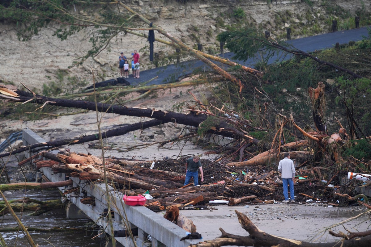

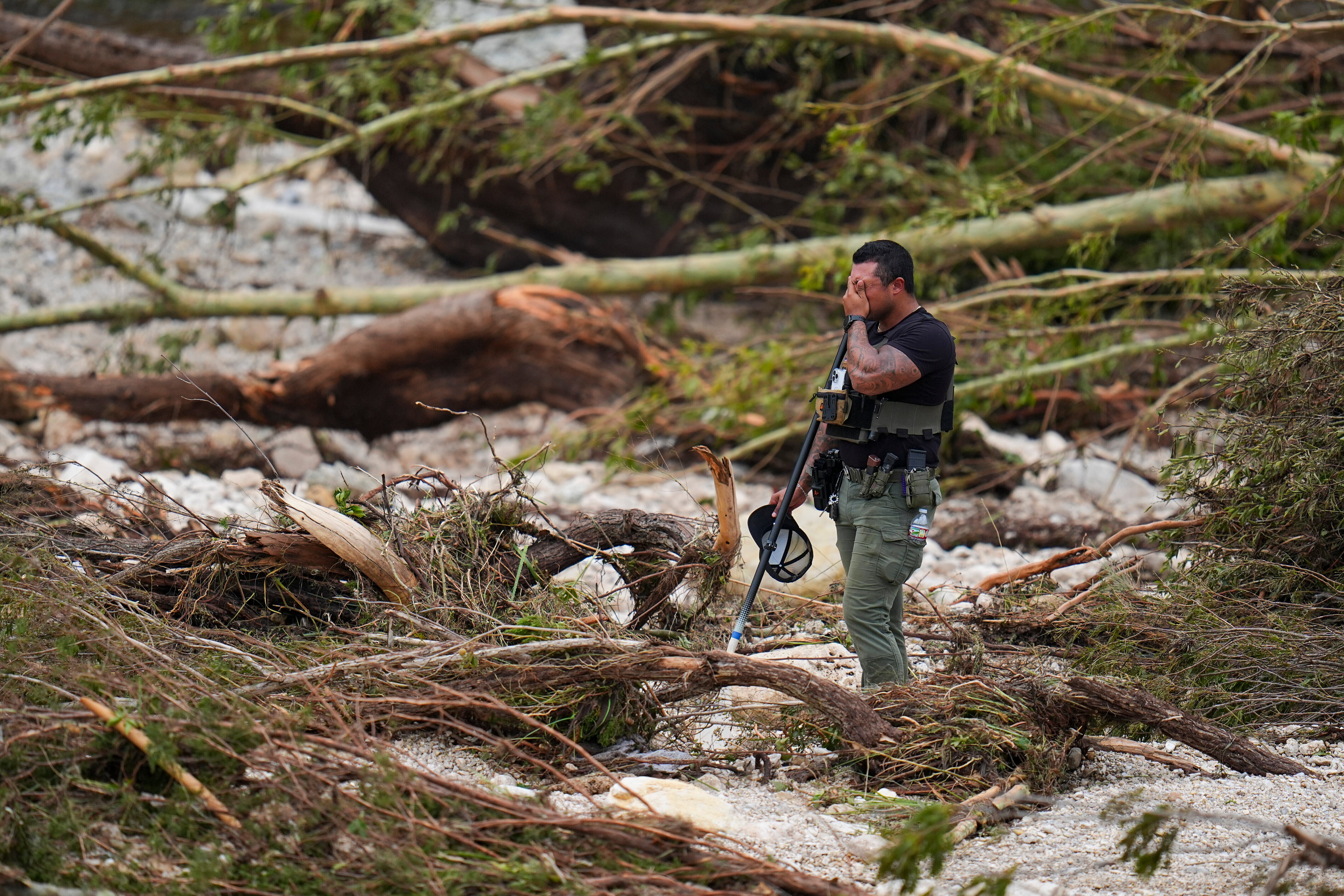
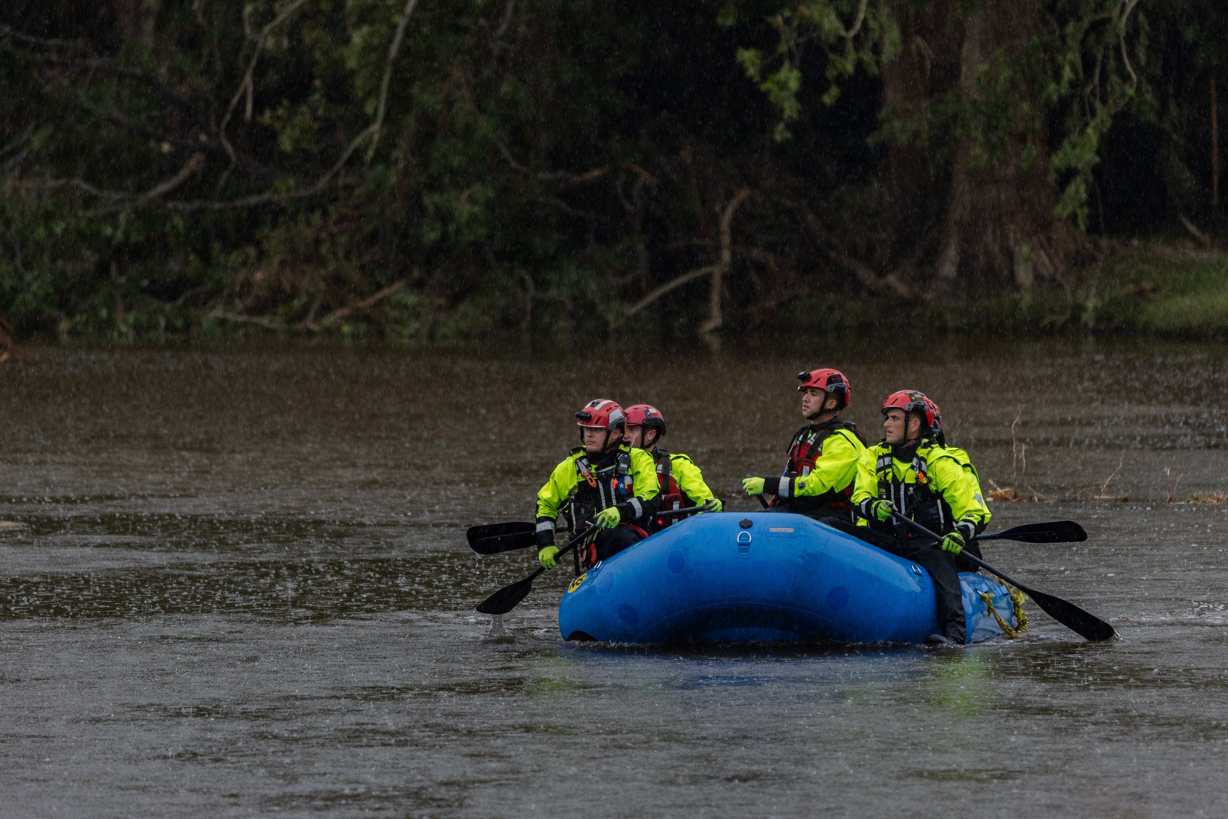
Former National Weather Service officials and meteorologists are defending Texas forecasters in the wake of sudden flooding that resulted in the deaths of at least 82 people, including 27 girls and counsellors Christian girls’ camp in Kerrville.
Response to the extreme event has been met with major scrutiny after some state and local officials accused the NWS of not providing accurate forecasts. There have also been questions over whether the agency was sufficiently staffed after the Trump administration slashed critical positions around the U.S.
But experts say that warnings issued were about as timely and accurate as could be expected with the data they had.
“The forecasting was good. The warnings were good. It’s always about getting people to receive the message,” Chris Vagasky, a meteorologist based in Wisconsin, told NBC News. “It appears that is one of the biggest contributors — that last mile.”
“The [weather forecasting offices] had adequate staffing and resources as they issued timely forecasts and warnings leading up to the storm,” Tom Fahy, legislative director for the NWS Employees Organization, a union that represents government employees, told the network.

Still, Fahy noted that the office for San Antonio and Austin is down by six employees from its typical staffing level. The San Angelo office, Fahy added, is down by four people, including a hydrologist. It’s a hydrologist’s job to assess stream flow.
“In San Angelo, there is no hydrologist, and that’s a problem,” Fahy said.
“Those are important positions that do need to be filled,” Vagasky said, but he pointed out that it “probably wasn’t a significant contributor to what happened.”
“Obviously, having both of these positions vacant for a prolonged time is not optimal, and certainly could have had negative impacts at some level,” Alan Gerard, the former director of the analysis and understanding branch at the National Severe Storms Laboratory of the National Oceanic and Atmospheric Administration, wrote in a blog post. “However, just looking at the actual warning services that NWS provided during the event, they were solid and provided the level of warning and alerts that the public should expect to receive for an event such as this.”
Social media posts from the Austin and San Antonio office warned of a particularly dangerous situation and a flash flood emergency in Kerrville — the worst-hit area — early on Thursday, urging residents to move to higher ground along the Guadalupe River.
“Heavy rainfall is pivoting south into Kerr and Gillespie Counties. Another 2-4 inches of rain possible in these areas. Flash Flood EMERGENCIES are in effect for Kerr County. Avoid travel through this area. Elsewhere, light to moderate rainfall ongoing for portions I-35 corridor,” it said in a post on X.
Flash flood warnings were also issued on Wednesday. Texas Hill Country, around San Antonio and central Texas, has long been known as “flash flood alley,” Steven Lyons, who retired four years ago after a decade as the meteorologist-in-charge at the National Weather Service’s San Angelo office, told The Washington Post.
Whether and how people in the area received and responded to these messages has been a point of debate. Water levels were getting alarmingly high in the early hours of Friday morning and survivors have said they received no emergency warnings. Kerrville City Manager Dalton Rice has said that authorities are committed to a full review of the emergency response.
Kerr County didn’t have weather sirens, according to KXAN. The county, which instructed people to move to higher ground on Friday morning, had previously taken steps to install flood gauges and barriers, Tom Moser, a former Kerr County commissioner, told The Post.
However, efforts to implement a larger flood warning system was met with resistance.
“Taxpayers won’t pay for it,” Rob Kelly, the Kerr County judge and its most senior elected official, told The New York Times.
The non-profit group Climate Central has tied this system to warmer-than-average sea surface temperatures, making for rainier and more intense storms. Heavy rain has continued to fall in the area since Thursday, producing two to three inches of rain an hour over portions of the Hill Country. The need for strengthened systems is only expected to increase due to human-caused climate change, which is making rain events more severe and frequent.
“If people had gotten the message before they had gone to sleep, would they have gotten out of there? Maybe,” Lyons said.
“The messaging is critical but so are the actions that people take based on the messaging. We can’t tell you how many raindrops are going to fall out of a thunderstorm,” he said.
With reporting from The Associated Press