
The Met Office has issued an amber weather warning with nearly a foot of snowfall expected in some areas – as parts of Britain are gripped by an Arctic snap.
Forecaster say wintry showers are likely to cause travel chaos on Thursday – with snow building up from 5am-9pm.
The amber warning covers the North York Moors – a national park between Middlesborough to Bridlington – with the wild conditions threatening to cut power and mobile phone reception in nearby areas.
The Met Office said: ‘Frequent wintry showers will feed inland from the North Sea, giving significant snow accumulations over the North York Moors and parts of the Yorkshire Wolds.
‘By the end of Thursday, as much as 15-25 cm may have accumulated on hills above 100m elevation, which is likely to cause substantial disruption.
‘Gusty winds, giving occasional blizzard conditions, and perhaps a few lightning strikes, may accompany some of the showers, posing as additional hazards.’
It comes as Brits have been told they could be set for another ‘Beast from the East’ next month as meteorologists monitor forecasts.
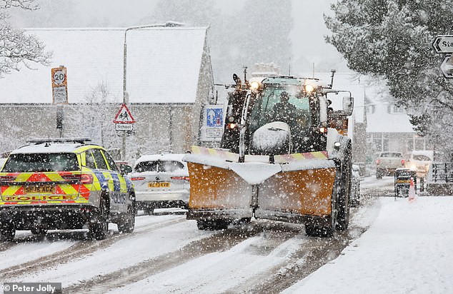
On Tuesday night, yellow weather warnings for snow and ice were in place in northern and southwest England, Northern Ireland, parts of Wales and much of Scotland.

Traffic battles though as heavy snow falls at Kingussie in the Scottish Highlands on Tuesday morning

Snow falls in Hartside, Cumbria, on Tuesday as the UK is gripped by a cold snap this week

Snow falls over Kidlandlee in Northumberland on Tuesday
Higher ground in Scotland and areas in northeast England are likely to see just short of a foot (25cm) of snow. Amber cold health warnings were also activated today.
And while snow is not anticipated in London, temperatures are expected to drop to -1C on Wednesday night in the capital.
The weather will be ‘markedly colder’ in the next week with ‘harsh frost’ expected towards its end.
A ‘thundersnow’ – when snow falls at the same time as thunderstorms – could also be on the cards.
Met Office Chief Forecaster Neil Armstrong said: ‘Cold Arctic air from the north is firmly in charge of the UK’s weather, bringing the first notable cold snap of this autumn and giving an early taste of winter weather.
‘As a result, winter hazards are likely through the next few days, with snow and ice a particular hazard, and the coldest conditions likely on Wednesday and Thursday.
‘Wintry showers will affect areas exposed to the brisk northerly wind, in particular Northern Ireland, southwest Wales, southwest England, northeast England and across the northern half of Scotland.
‘Whilst not all places will see lying snow, where showers are most frequent accumulations of 2-5 cm will be possible.
‘On higher ground in Scotland, 15-20 cm could accumulate, and potentially as much as 15-25 cm over the North York Moors and Yorkshire Wolds.’
In addition to snow, ice will be an ongoing hazard, particularly overnight in the coming days.
Neil Armstong added: ‘Temperatures are well below average for the time of year and could get as low as -11°C in rural parts of Scotland on Thursday night, with daytime temperatures generally in low single figures for many. With clear skies, overnight ice could create some particularly tricky travel conditions.’
The Met Office revealed forecast models are suggesting the potential for a phenomenon called Sudden Stratospheric Warming (SSW). This caused the Beast from the East in February 2018 when the UK was hit by significant snowfall.


The Met Office has issued a series of weather warnings for Tuesday (left) and Wednesday (right)


The Met Office has also issued warnings for Thursday (above), including an amber alert (right)

Snow falls over Kidlandlee in Northumberland on Tuesday

A snow plough at Nenthead in Cumbria on Tuesday as Met Office warnings come into force

People walk across a frosty Wimbledon Common in South West London on Tuesday

Snow at Carrshield in Northumberland on Tuesday as the country is gripped by a cold snap

Frost-covered trees in the cold on Tuesday at Burnham Beeches Nature Reserve in Buckinghamshire

Flooding around Worcester Racecourse on Tuesday morning as temperatures drop this week
SSW – which could happen in the coming weeks – refers to rapid warming in the stratosphere, which can switch the direction of winds, bringing easterlies to Britain.
This change can alter the UK’s weather patterns, weakening low pressure areas and moving the jet stream south – leading to high pressure over the North Atlantic, which blocks the flow of mild Atlantic air and drags in cold air from the continent.
SSW events are therefore linked to very cold weather, with the Beast from the East caused when an icy blast of freezing Siberian winds brought freezing temperatures and heavy snow in 2018 – causing travel chaos compounded when Storm Emma hit.
The Met Office said SSW events do not always cause very cold weather, but greatly increase the chance of it because a cold snap is more likely to follow than not.
The conditions in February 2018 were among the worst the UK has experienced in recent decades – with thousands of schools closed, hospital appointments cancelled, transport networks grinding to a halt and motorists stranded in cars overnight.
Met Office spokesman Stephen Dixon told the Mail: ‘This year there is a signal for a sudden stratospheric warming very early in the season, near the end of November.
‘Although we occasionally see such events in November, it is relatively early in the winter for this to be occurring.
‘This suggests that the chances of a cold start to winter is higher than in recent years, though it’s too early to be definitive about precise impacts on the UK at this stage.’
The Met Office also said in a blog post yesterday that it was observing ‘some models suggesting the potential for an SSW event in early December’.
The potential for an SSW event is not linked to this week’s weather – and for now, the Met Office has issued multiple yellow weather warnings for snow and ice affecting parts of Scotland and northern England yesterday until Thursday.
There is even an amber snow warning for Yorkshire on Thursday, from 5am until 9pm.
Sub-zero temperatures are expected widely during the first cold snap of the winter, with lows of -12C expected in rural parts of Scotland on Thursday night.
Met Office meteorologist Alex Burkill said cold air is coming from Siberia and crossing over the Arctic Ocean to the UK.
Wet weather is expected across Scotland, Northern Ireland, and northern and western parts of England and Wales today.
‘With that cold air we have across us, no wonder we are going to see some sleet and snow mixed in with that as well,’ Mr Burkill added.
Icy patches are expected across the country today, which may lead to some ‘difficult, slippery conditions’, and parts of Scotland may see snow.
Temperatures will be on the ‘low side’ in the north where they are ‘below average for this time of year’, but they will be ‘closer to normal’ in the South today.
Mr Burkill said the temperature is going to be ‘markedly colder’ than it was this time last week.
He continued: ‘There is an area of low pressure that’s pushing its way southwards as we go through Tuesday night and into Wednesday.
‘That’s bringing the focus for that burst of showery rain, with a bit of sleet, bit of hill snow mixed in, but a lot of that is going to be clearing away towards the south as we go through the morning.
‘I’m not sure how much wintry stuff we’re going to see across the southern areas, mostly just falling as rain. Then once that clears away, we just have this brisk northerly wind that’s piling down, the Arctic air coming through.
‘And because of the direction that that wind is coming from, it’s really pivotal to where we see further showery bursts of rain, sleet and snow.
‘So yes, northern parts of Scotland seeing plenty, and also down the eastern side of England and eastern Scotland as well – plenty of these rain, sleet and snow showers.’
Temperatures for much of the UK will be down ‘a couple of degrees’ today, including across the south where it will turn colder than average for this time of year.
Accumulations of 2cm to 5 cm of snow are possible in Scotland today on ground above 150 metres in elevation, and 5cm to 10cm above 400 metres.

Snow falls over Kidlandlee in Northumberland on Tuesday

A cold and frosty start to the day in the Oxfordshire countryside at Dunsdenon Tuesday


North facing coastal areas will be worst-hit by snow tomorrow and on Thursday, with 2cm to 5cm possible in some low-lying areas in the North and East where showers are frequent.
On hills in parts of Northern Ireland, the North East of England and Scotland, 5cm to 10cm of snow could fall. Accumulations of 15cm to 25cm are possible on ground above 300 metres in parts of North East England and Scotland.
Mr Burkill said. ‘Watch out for some brisk winds, particularly towards the west, could be close to gales through both Wednesday and Thursday. That will add to the cold feel for many places, too.’
On Thursday, northern areas are more likely to have sleet and snow with some showers across western parts.
Scotland and the eastern side of northern England can expect snow, which might cause ‘some disruption’.
Thursday night into Friday will be a ‘particularly chilly night’ with ‘widespread harsh frost’.
Rain will sweep in across Northern Ireland and then feed into western parts of Scotland, Wales and England.
The East will be dry and brighter but the rain will push through later on.
Further rain is expected at the weekend but the air will be milder so the temperatures will rise.
The UK Health Security Agency (UKHSA) has issued an amber cold health alert for North West England as well as the North East and Yorkshire and the Humber.

Snow accumulations for this week up to midday on Thursday are shown in the above map

The UK Health Security Agency has issued amber and yellow cold health alerts for England
This will run from 12pm yesterday until 8am on Saturday – with all other regions in England placed under a yellow alert covering the same period.
Officials said expected low temperatures are ‘likely to result in increased use of health care services by vulnerable people and an increase in risk to health for individuals aged 65 years and over, those with pre-existing health conditions (including respiratory and cardiovascular diseases) and some other vulnerable groups, such as those sleeping rough’.
Dr Agostinho Sousa, head of extreme events and health protection at the UKHSA, said: ‘This is the first prolonged cold spell of the season, and it is therefore vital to check in on friends, family and neighbours that are most vulnerable.
‘The forecasted temperatures can have a serious impact on the health of some people, leading to increased risk of heart attacks, strokes and chest infections, particularly for individuals over the age of 65 and those with pre-existing health conditions.’
The snow warning for Scotland today is the Met Office’s first such alert for the UK since February 18. The last snow warning for England was on February 15.
Katherine Crawford, chief executive of Age Scotland, said: ‘As the weather turns colder again, older people might find it increasingly difficult to get out and about safely, leading to increased levels of loneliness and isolation.
‘Blocked or icy roads and paths can affect someone’s ability to collect shopping and prescriptions, get to doctors’ appointments, visit friends and family, and attend social groups and clubs, without the fear of falling and needing to go to hospital.

The ‘Beast from the East’ in 2018 caused extreme weather, including on the M20 in Kent

An accident on the M66 in Manchester involving 16 vehicles during the Beast from the East
‘We’d urge everyone to check in on older family, friends and neighbours during periods of extreme weather. Small gestures such as clearing and salting paths, or offering to collect essentials can make a huge difference – particularly for older people who live alone.’
With temperatures plummeting, the British Heart Foundation (BHF) is warning people with heart conditions of the potential dangers posed by the cold weather.
Ruth Goss, senior cardiac nurse at the BHF, said: ‘Cold temperatures can increase the risk of heart attacks and strokes, and people with cardiovascular disease are also more at risk of serious illness if they get seasonal respiratory infections like flu.
‘It’s especially important that people living with heart conditions are well prepared for the cold snap this winter by wrapping up warm and having their free flu jab.’
BHF tips include keeping indoor temperatures to at least 18C, layering up with socks, jumpers and blankets to trap in heat, staying active indoors and eating warming meals and healthy hot drinks and wearing a scarf loosely around your mouth and nose to breathe in warmer air if you have angina.
The cold snap follows Storm Claudia last Friday which brought heavy rain, strong winds and flooding to the UK. A major incident was declared in Monmouth, where people were rescued or evacuated from homes that were deluged.