
It is officially colder in New York City than in parts of Antarctica after a weeks-long cold snap reached new lows over the weekend.
The Big Apple experienced temperatures of 3F in the early hours of Sunday, with wind chill bringing the real feel to 14 degrees below zero. In contrast, the temperature at McMurdo Station in Antarctica was 21F.
And the temperature difference persisted throughout the day. On Sunday afternoon, it was 13F in New York City, and it was 23F at McMurdo Station.
Other parts of the northeast reported wind chills as low as minus 40F.
The National Weather Service issued an extreme cold warning in New York City from 10am Saturday through 1pm Sunday. An accompanying Wind Advisory was put into effect from 9am Saturday through midnight.
On Friday, FOX Weather Meteorologist Stephen Morgan said: ‘The last time [New York City] had a warning issued similar to what we have this morning was in 2004.’
New Yorkers were urged to stay indoors, as sub-zero windchills can cause frostbite in minutes.
Hypothermia or death are also possible in those temperatures if precautions are not taken. So far this year in New York City, at least 17 people were found dead outside in the cold, and the cause of death for 13 of them was confirmed as hypothermia.

Bundled-up New Yorkers are experiencing temperatures even colder than some parts of Antarctica

The fountain in New York City’s Bryant Park is pictured totally frozen over on February 2, during a long stretch of freezing or nearly-freezing temperatures

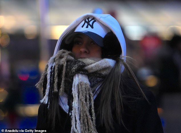
New Yorkers are pictured dressed for the extreme cold on Saturday. This weekend had the coldest temperatures of the winter so far, going as low as 3F in the early hours of Sunday

A McMurdo Station (pictured) in Antarctica, the temperature in the early hours of Sunday was 21F, compared to New York City’s 3F, and it remained warmer throughout the day
‘New Yorkers should treat this cold snap with the seriousness it demands. These temperatures are dangerous, and even brief time outdoors can be life-threatening,’ New York City Mayor Zohran Mamdani said in a weather alert on Friday.
Sunday marked the 16th consecutive day of nearly-freezing or below-freezing temperatures in the city, according to AccuWeather’s website.
Between January 24 and February 1, every day was significantly below freezing, with the highest temperatures reaching 24F.
The sub-freezing streak was broken Monday through Friday, but temperatures went no higher than 35F.
Saturday and Sunday were the coldest days in the city so far this winter. ‘The deep freeze has returned to the northeastern United States this weekend,’ AccuWeather Chief Meteorologist Jon Porter said.
‘In many parts of the Northeast away from the coast, this prolonged stretch of cold is the most extreme in at least the last decade and, in some areas, the last two decades,’ the meteorologist added.
‘Many locations will end up with a streak of days below freezing that falls into the top 10 longest such streaks on record.’
The last cold snap in New York City similar to this year was in 2018, when the Big Apple experienced 14 consecutive days at or below freezing.

Blocks of ice in New York City’s East River are pictured in late January, during a nine-day streak of below-freezing temperatures in the city

A woman is pictured walking in New York City on January 25 during a winter storm that dumped almost a foot of snow on the city. A 16-day-long streak of nearly freezing and below-freezing temperatures began on January 24

An iconic New York City yellow cab is pictured buried in snow. The cold snap this year was the longest since 2018
The longest streak of freezing temperatures in the city was 16 days in 1961.
The current frigid temperatures are due to gusts of Arctic air passing down through the tundra north of Hudson Bay, Canada.
The worst of the cold is expected to subside in the second and third weeks of February as warm air from the Pacific Ocean travels east across the continental US.
Although that will provide some much-needed relief for bundled-up New Yorkers, AccuWeather warns that the warm air may create additional problems.
The sudden increase in temperature could disrupt thaw-and-freeze cycles, and it could cause fog, freezing rain, sleet and wet snow.