
Storm Chandra has brought weather chaos this week with strong winds, heavy rain and snow battering much of the UK, with the Met Office issuing further yellow warnings till Friday.
As forecasters predict further flooding on Thursday and Friday, fears intensify that the heavy rainfall could bring the worst flooding seen in more than a decade.
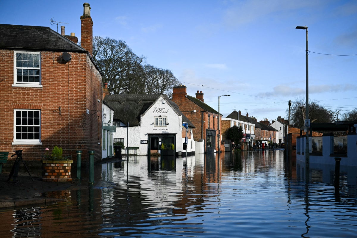
Dozens of flood warnings remain in place across the UK, with a major incident also declared in Somerset as a result of the disruption caused by the downfalls earlier in the week.
Lesley and John Parker, a retired couple based on the Somerset Levels, said the conditions were the scariest they have seen since their home was devastated by flooding in 2014, when 3ft of water inside the house forced them to evacuate.
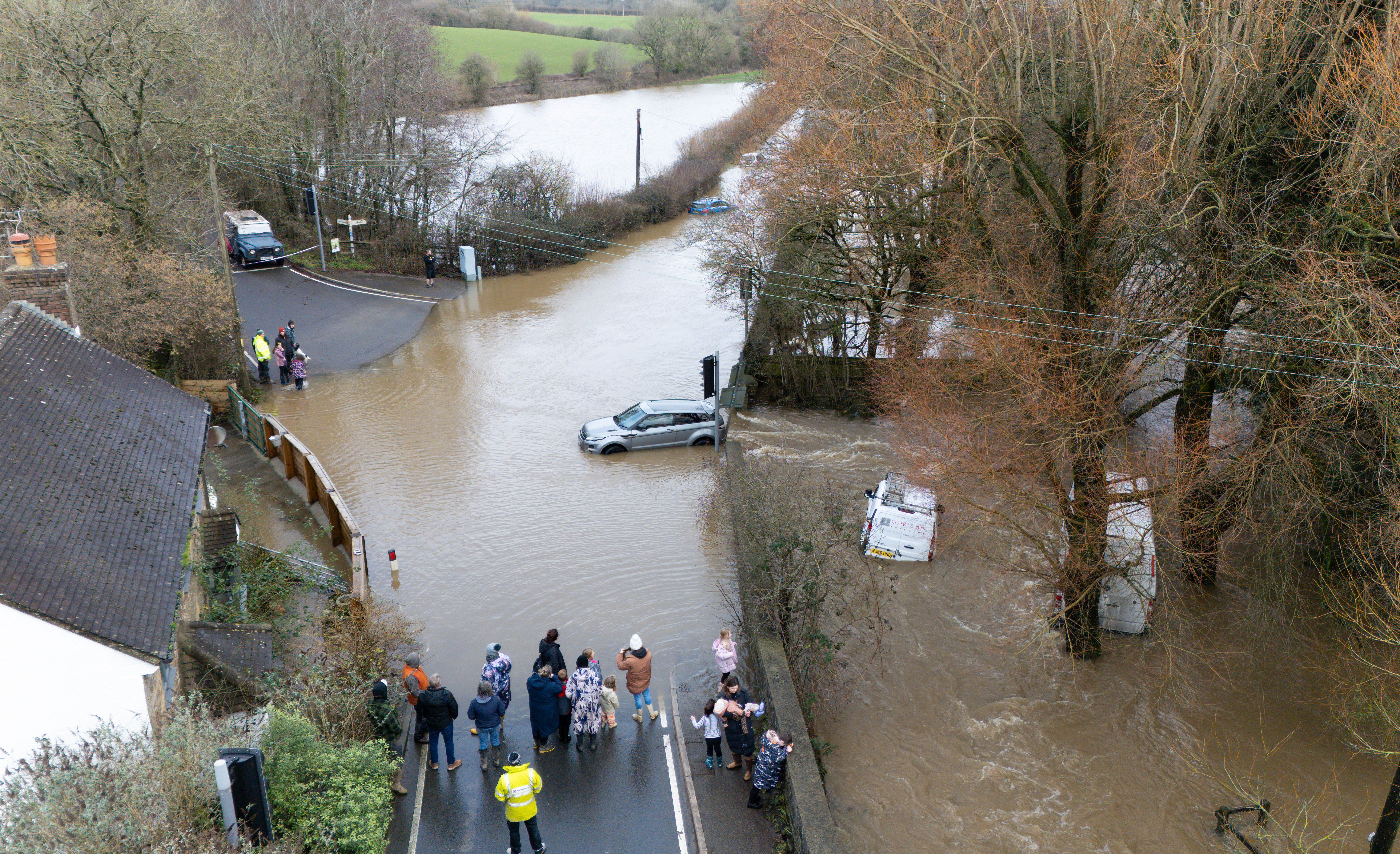
Further rain is predicted on Thursday to lead to more flooding and transport disruption, with Storm Chandra already breaking several new January daily rainfall records.
Longer journey times and cancellations are expected to impact road, rail, air and ferry services, as well causing some roads and bridges to close.
The Met Office stated: “A band of rain will arrive across Cornwall on Thursday afternoon then move northeast across the warning area through the evening and clearing during early Friday.
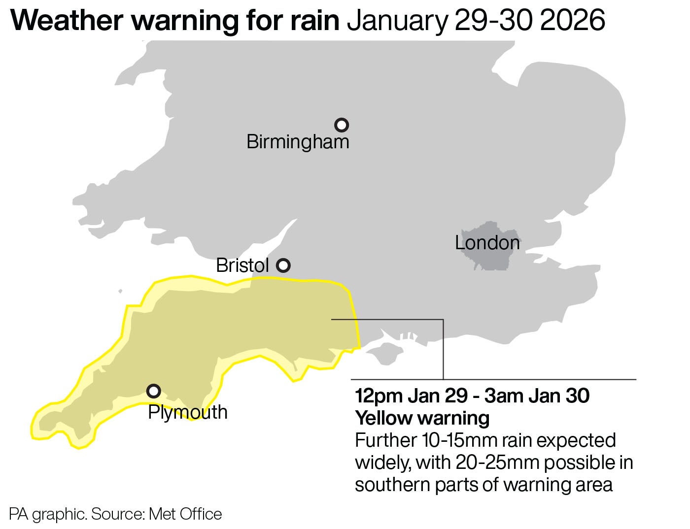
“The rain is only likely to last for a few hours in any one location but will be at heavy at times. A further 10-15 mm of rain is expected fairly widely, but some locations, most likely in the south of the area, could see 20-25 mm. The likelihood of impacts from these rainfall amounts is higher than normal due to saturated ground and ongoing flooding following Storm Chandra.”
The yellow weather warning for Thursday is in place for London and South East England, as well as South West England.
Earlier this week a lorry driver died in the New Forest after crashing into a river on Tuesday in the aftermath of Storm Chandra.
A “major incident” of flooding was declared in Somerset on Tuesday bySomerset Council, the Environment Agency and emergency services, who worked closely to support communities impacted by heavy rain and extensive flooding overnight.
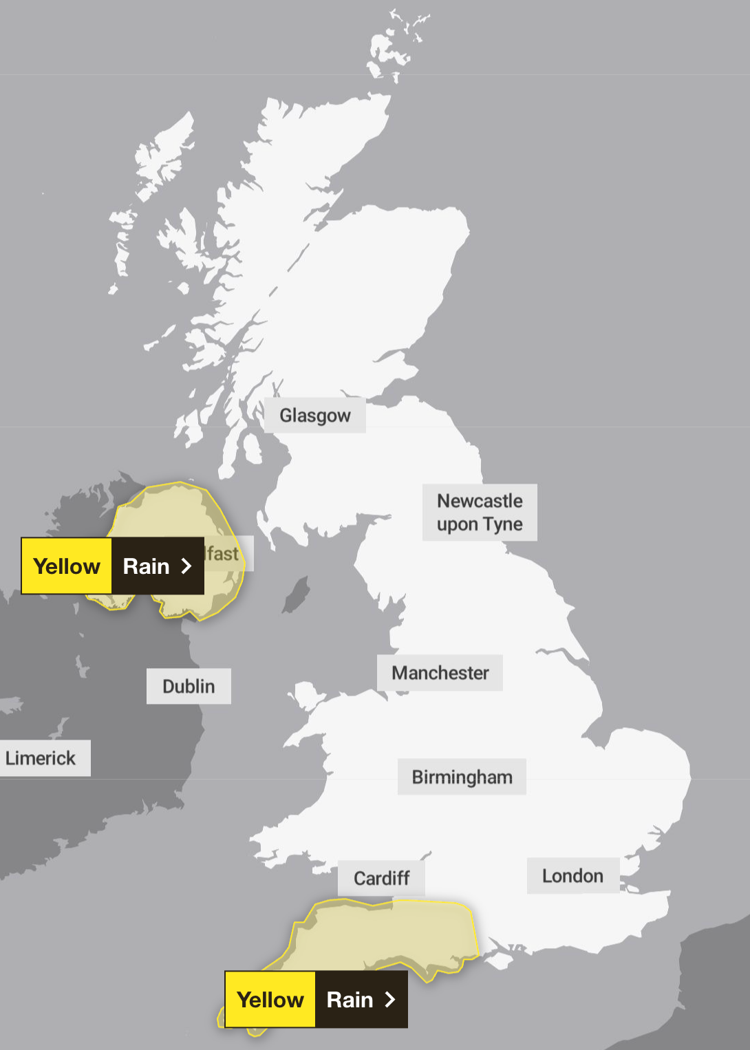
There are two yellow weather warnings for rain in place for Friday across parts of Northern Ireland, London and South East England and across South West England.
There is a small chance that homes and businesses in Ireland could be flooded and that some communities will become cut off by flooded roads. The Met Office has also warned that there is a slight chance of power cuts and loss of other services.
The forecasting service said: “Spells of heavy rain will move over Northern Ireland during Thursday night and Friday. While the wettest conditions are likely over Antrim and Down, there is potential for many areas to see 10-25 mm build up, with 40-60 mm over some hills. Rain will be accompanied by strong southeasterly winds, especially Thursday night and early Friday.”
Here’s the Met Office’s four-day forecast for the UK:
Thursday:
Rather cloudy and breezy with some rain and hill snow lingering in the northeast, whilst showers give way to more persistent rain towards the southwest. Some brighter breaks developing elsewhere.
Outlook for Friday to Sunday:
Friday looks unsettled with brisk winds. Rather cloudy skies giving outbreaks of rain for many. Brighter and becoming less breezy for most over the weekend, albeit with scattered showers still.