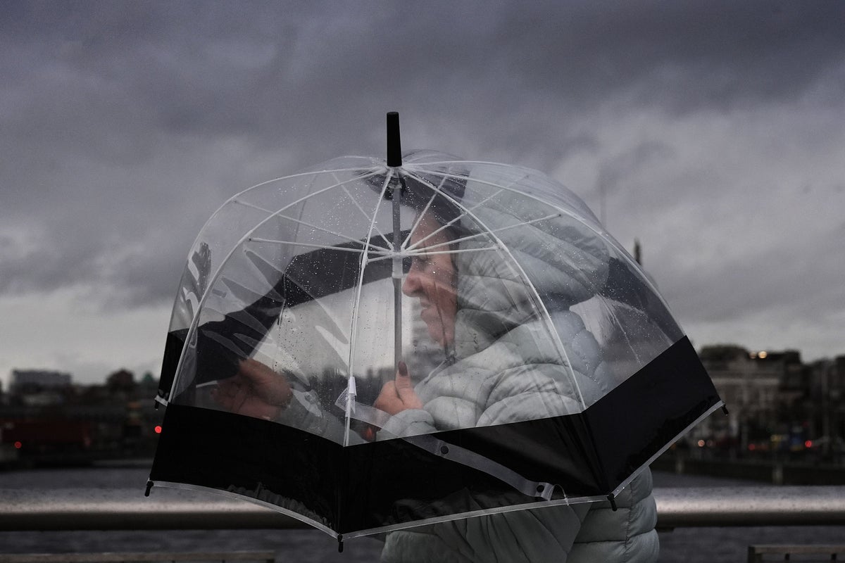
Storm Benjamin is set to batter the UK on Thursday with winds up to 75mph as the Met Office issued “danger to life” weather warnings.
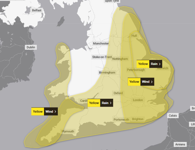
The forecaster has issued four yellow weather warnings across England and Wales with it predicting heavy downpours to accompany the powerful gusts.
Large waves and debris thrashed onto sea fronts, coastal roads, and properties in the blustery conditions could lead to injuries and a “danger to life”, the Met Office warned.
Deputy chief meteorologist Dan Harris said: “Low pressure moving across the south of the UK on Thursday will bring both a spell of heavy rain and areas of strong winds.”
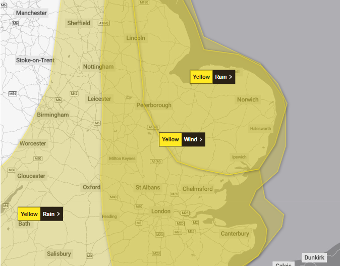
The weather warnings will begin at 3am with an alert for wind in the south east, covering much of East Anglia, Lincolnshire, and parts of eastern Yorkshire, lasting until midnight.
Two alerts will also be in place from midnight for rain covering all of southern and eastern England, parts of southern Wales, the Midlands, and stretching up towards the north west.
They will end at 6pm for all areas other than East Anglia and Lincolnshire, where an alert will stay in place until 9pm.
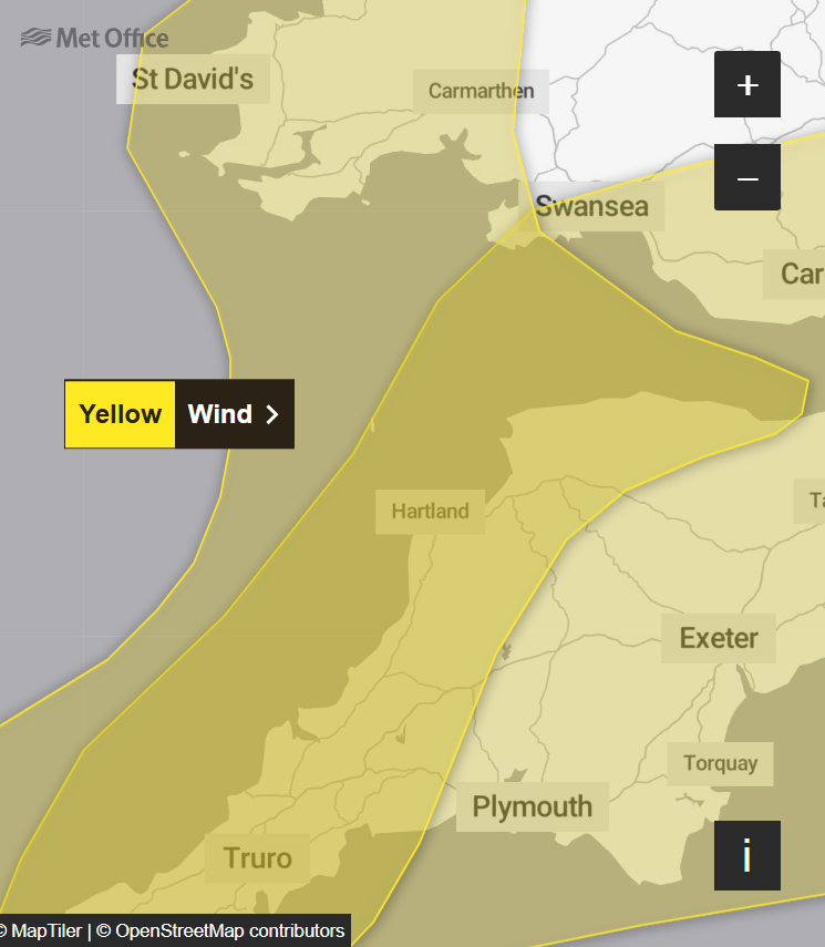
And as Storm Benjamin moves from the English Channel across the UK, an additional warning for wind will cover parts of south-west England and western Wales from 6am to 3pm, with a risk of gales reaching 55mph along exposed coasts and headlands.
Cornwall, Devon, Somerset and parts of west Wales, including Swansea, Pembrokeshire and up to Anglesey, will be affected.
The Met Office said: “There is a small chance of gusts of 40 to 45mph across parts of Kent and Sussex arriving in the early hours of the morning and up to 55mph in coastal areas here too. Conditions are likely to improve here however, at least for a time, during Thursday morning.
“As Storm Benjamin then moves across the southeast of England, stronger northeast to northwest winds are likely to develop. Gusts of 50 to 60mph are probable quite widely, with 65 to 70mph possible near coasts.
“There is a smaller chance, should Storm Benjamin be at the stronger end of expectations, that wind gusts in excess of 70mph could develop for a time very locally, this most likely late morning and into the afternoon.”
To avoid injury from flying debris or property damage, the Met Office suggests checking for loose items outside the home, such as bins, garden furniture, trampolines, tents, sheds, and fences.
The storm, which was named by MeteoFrance, will have the greatest impact on France and Belgium, but also influence the unsettled weather in the UK.
A yellow warning for rain has been issued from midnight to 9pm across the south and east of England and some parts of south Wales, as the forecaster warned that flooding of homes and businesses is likely.
Some areas could see as much as 50mm of rain on Thursday morning, especially in the South West.
“There is a small chance a few places could exceed this, most likely over North Devon and Cornwall and more generally in the east of the highlighted area,” the Met Office said.
“Conditions are expected to turn windy with a chance of gales, initially along southern and eastern coasts, but more widely across southern Britain during Thursday daytime.”
The downpours may cause disruption to public transport, difficult driving conditions because of spray and road flooding, as well as the flooding of some homes and businesses, the forecaster said.
UK five-day weather forecast
Tonight:
Showers die down across Scotland, leaving a chilly night with mist and patchy frost. Heavy rain spreads north and eastwards across England, Wales and Northern Ireland. Breezy around southern coasts.
Thursday:
Rain remains across central and southern England, moving eastwards. Staying windy in the south with gales likely across western and eastern coasts. Feeling colder than in recent days.
Outlook for Friday to Sunday:
Winds will ease and rain clearing to sunshine and showers by Friday. Colder Saturday with further scattered showers, these wintry over the Scottish mountains. Wet across the West on Sunday.